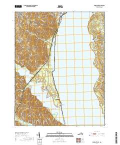
2019 Map of Widewater
USGS Topo · Published 2019About this map
The Potomac River dominates this coastal landscape, serving as the boundary between Stafford County, Virginia and Charles County, Maryland. Along the Virginia shore, the settlement of Widewater sits near the marshes of Brent Marsh, while the residential corridors of Midway Island and Arkendale extend inland. The shoreline is punctuated by numerous named landings and small communities such as Widewater Beach and Seegars Point, illustrating a long history of water-oriented settlement.
Find a feature on this map
101 named features on this map. Tap any name to fly to it.
Don’t see what you’re looking for? This feature index may not catch every label — zoom into the map to look around manually.
Map Details
Editions of this 2019 Widewater Map
This is the sole edition of this map. No revisions or reprints were ever made.
Other maps of this area

1889 · Fredericksburg
USGS Topo · 1:125,000

1890 · Mt. Vernon
USGS Topo · 1:125,000

1891 · Mt. Vernon
USGS Topo · 1:125,000

1892 · Fredericksburg
USGS Topo · 1:125,000

1894 · Fredericksburg
USGS Topo · 1:125,000

1894 · Mt. Vernon
USGS Topo · 1:125,000

1897 · Mt. Vernon
USGS Topo · 1:125,000

1913 · Indian Head
USGS Topo · 1:62,500

1913 · Nanjemoy
USGS Topo · 1:62,500

1923 · Indian Head
USGS Topo · 1:48,000