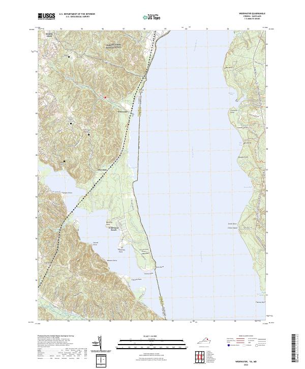
2022 Map of Widewater
USGS Topo · Published 2022About this map
Brent Marsh and the wide expanse of the Potomac River dominate this coastal boundary where Stafford County, Virginia, meets Charles County, Maryland. The Virginia shoreline is characterized by a high density of ancestral sites, including the Edrington Family Cem and the combined church and burial grounds at Oak Grove Baptist Church Cem and Salem United Methodist Church Cem. These features, alongside the Waller Ford Cem, offer significant data for genealogists tracing long-established families in the Widewater and Arkendale areas.
Find a feature on this map
64 named features on this map. Tap any name to fly to it.
Don’t see what you’re looking for? This feature index may not catch every label — zoom into the map to look around manually.
Map Details
Editions of this 2022 Widewater Map
This is the sole edition of this map. No revisions or reprints were ever made.
Other maps of this area

1889 · Fredericksburg
USGS Topo · 1:125,000

1890 · Mt. Vernon
USGS Topo · 1:125,000

1891 · Mt. Vernon
USGS Topo · 1:125,000

1892 · Fredericksburg
USGS Topo · 1:125,000

1894 · Fredericksburg
USGS Topo · 1:125,000

1894 · Mt. Vernon
USGS Topo · 1:125,000

1897 · Mt. Vernon
USGS Topo · 1:125,000

1913 · Indian Head
USGS Topo · 1:62,500

1913 · Nanjemoy
USGS Topo · 1:62,500

1923 · Indian Head
USGS Topo · 1:48,000