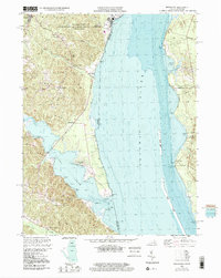
1998 Map of Widewater
USGS Topo · Published 2001About this map
Widewater and the surrounding Stafford County shoreline anchor this detailed 1990s study of the riverine border between Virginia and Maryland. The landscape is defined by the broad reach of the Potomac River and its transition into Aquia Creek, with topographic and bathymetric data revealing the intricate shoals and marshes like Brent Marsh. Historically significant local waypoints such as Mountjoy Store, Decatur Store, and the curiously named Youbedamn Landing illustrate the enduring importance of river-access points and small rural crossroads.
Find a feature on this map
44 named features on this map. Tap any name to fly to it.
Don’t see what you’re looking for? This feature index may not catch every label — zoom into the map to look around manually.
Map Details
Editions of this 1998 Widewater Map
This is the sole edition of this map. No revisions or reprints were ever made.
Other maps of this area

1889 · Fredericksburg
USGS Topo · 1:125,000

1890 · Mt. Vernon
USGS Topo · 1:125,000

1891 · Mt. Vernon
USGS Topo · 1:125,000

1892 · Fredericksburg
USGS Topo · 1:125,000

1894 · Fredericksburg
USGS Topo · 1:125,000

1894 · Mt. Vernon
USGS Topo · 1:125,000

1897 · Mt. Vernon
USGS Topo · 1:125,000

1913 · Indian Head
USGS Topo · 1:62,500

1913 · Nanjemoy
USGS Topo · 1:62,500

1923 · Indian Head
USGS Topo · 1:48,000