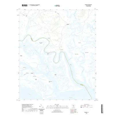
2020 Map of Wiggins
USGS Topo · Published 2020About this map
The Combahee River and Chehau River dominate this Lowcountry landscape, forming a complex network of brackish waterways and marsh islands in the decades following the establishment of the Intracoastal Waterway. The settlement of Wiggins sits near the upper reaches of the map, while Chisolm is positioned further south near the confluence of Wimbee Creek. This area is characterized by significant landforms such as Old Combahee Island and Gunboat Island, which speak to the historical maritime navigation and land-use patterns of the South Carolina coast.
Find a feature on this map
35 named features on this map. Tap any name to fly to it.
Don’t see what you’re looking for? This feature index may not catch every label — zoom into the map to look around manually.
Map Details
Editions of this 2020 Wiggins Map
This is the sole edition of this map. No revisions or reprints were ever made.
Other maps of this area

1918 · Green Pond
USGS Topo · 1:62,500

1919 · Edisto Island
USGS Topo · 1:62,500

1920 · St. Helena Sound
USGS Topo · 1:62,500

1943 · Edisto Island
USGS Topo · 1:62,500

1943 · Green Pond
USGS Topo · 1:62,500

1944 · Fort Fremont
USGS Topo · 1:62,500

1947 · Savannah
USGS Topo · 1:250,000

1948 · St. Helena Sound
USGS Topo · 1:62,500

1948 · Savannah
USGS Topo · 1:250,000

1956 · Frogmore
USGS Topo · 1:24,000