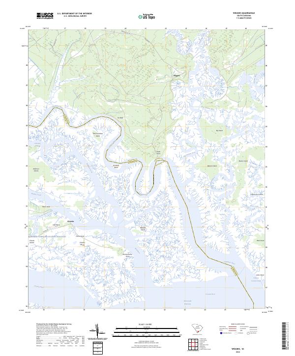
2024 Map of Wiggins
USGS Topo · Published 2024About this map
Wiggins and Chisholm sit within a coastal landscape defined by the intricate confluence of the Combahee River, Ashepoo River, and Chehaw River. This recent survey reveals a terrain dominated by expansive wetlands and tidal islands, including Warren Island and Big Island, separated by a maze of waterways like the Ashepoo Coosaw Cutoff and Schooner Channel. The presence of the Marine Corps Air Station Beaufort in the southwest corner and the Intracoastal Waterway running through the Coosaw River highlights the region's contemporary strategic and maritime importance. Local landmarks such as Tar Bluff and Fields Point provide fixed terrestrial reference points amidst the shifting marshland, while historical land divisions are noted by the Colleton Co Beaufort Co line traversing the river channels.
Find a feature on this map
39 named features on this map. Tap any name to fly to it.
Don’t see what you’re looking for? This feature index may not catch every label — zoom into the map to look around manually.
Map Details
Editions of this 2024 Wiggins Map
This is the sole edition of this map. No revisions or reprints were ever made.
Other maps of this area

1918 · Green Pond
USGS Topo · 1:62,500

1919 · Edisto Island
USGS Topo · 1:62,500

1920 · St. Helena Sound
USGS Topo · 1:62,500

1943 · Edisto Island
USGS Topo · 1:62,500

1943 · Green Pond
USGS Topo · 1:62,500

1944 · Fort Fremont
USGS Topo · 1:62,500

1947 · Savannah
USGS Topo · 1:250,000

1948 · St. Helena Sound
USGS Topo · 1:62,500

1948 · Savannah
USGS Topo · 1:250,000

1956 · Frogmore
USGS Topo · 1:24,000