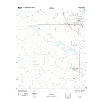
2012 Map of Wiggins
USGS Topo · Published 2012About this map
Wiggins serves as the central hub of this Stone County landscape, where the modern grid of the city meets the established rural patterns of southeast Mississippi. The northern reach is anchored by the Flint Creek Reservoir, while to the south, the Mississippi Gulf Coast Community College Perkinston Campus defines the settlement of Perkinston. This area is particularly rich in family and community history, evidenced by a high density of burial grounds such as Shadeville Park Memorial Cem, Welcome Hill Cem, and the Hickman Cem.
Find a feature on this map
92 named features on this map. Tap any name to fly to it.
Don’t see what you’re looking for? This feature index may not catch every label — zoom into the map to look around manually.
Map Details
Editions of this 2012 Wiggins Map
This is the sole edition of this map. No revisions or reprints were ever made.
Other maps of this area

1947 · Wiggins
USGS Topo · 1:62,500

1949 · Wiggins
USGS Topo · 1:62,500

1953 · Mobile
USGS Topo · 1:250,000

1954 · McHenry
USGS Topo · 1:62,500

1955 · Savannah
USGS Topo · 1:62,500

1957 · Mobile
USGS Topo · 1:250,000

1958 · Carnes
USGS Topo · 1:62,500

1960 · Mobile
USGS Topo · 1:250,000

1963 · Mobile
USGS Topo · 1:250,000

1965 · Mobile
USGS Topo · 1:250,000