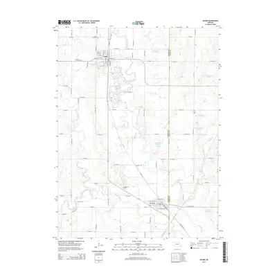
2014 Map of Wilber
USGS Topo · Published 2014About this map
The Big Blue River meanders through this portion of Saline and Gage counties, defining the agricultural landscape around the city of Wilber. This 2014 survey documents a region deeply connected to its heritage, as seen in the several community burial grounds including Cecho Slovansky Cem, Sunny Side Cem, and Oak Grove Cem. The area's water management is highly visible through a network of local reservoirs and creeks, such as Turkey Cr and Clatonia Cr, which support the surrounding farms.
Find a feature on this map
76 named features on this map. Tap any name to fly to it.
Don’t see what you’re looking for? This feature index may not catch every label — zoom into the map to look around manually.
Map Details
Editions of this 2014 Wilber Map
This is the sole edition of this map. No revisions or reprints were ever made.
Other maps of this area

1897 · Lincoln
USGS Topo · 1:125,000

1935 · Dorchester
USGS Topo · 1:48,000

1940 · Dorchester
USGS Topo · 1:62,500

1955 · Lincoln
USGS Topo · 1:250,000

1957 · Lincoln
USGS Topo · 1:250,000

1957 · Plymouth
USGS Topo · 1:24,000

1957 · Clatonia
USGS Topo · 1:24,000

1957 · Beatrice West
USGS Topo · 1:24,000

1957 · Wilber
USGS Topo · 1:24,000

1958 · Lincoln
USGS Topo · 1:250,000