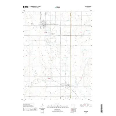
2017 Map of Wilber
USGS Topo · Published 2017About this map
Wilber serves as a prominent hub in this corner of Saline County, where the grid of city streets gives way to the winding course of the Big Blue River. This waterway is the central geographic feature of the area, creating a complex floodplain that contrasts with the surrounding agricultural sections. The map reveals a high density of rural cemeteries, such as the Cecho-Slovansky Cem and Sunny Side Cem near the town center, which reflect the heritage and early settlement patterns of the local community. Further south, De Witt is positioned near the junction of the river and Turkey Creek, marking another vital concentration of residence and commerce. Numerous man-made water bodies like Huneke Reservoir and Schuerman Reservoir illustrate the 21st-century management of the prairie landscape, while the county boundary between Saline Co and Gage Co bisects the eastern reaches of the quadrangle.
Find a feature on this map
82 named features on this map. Tap any name to fly to it.
Don’t see what you’re looking for? This feature index may not catch every label — zoom into the map to look around manually.
Map Details
Editions of this 2017 Wilber Map
This is the sole edition of this map. No revisions or reprints were ever made.
Other maps of this area

1897 · Lincoln
USGS Topo · 1:125,000

1935 · Dorchester
USGS Topo · 1:48,000

1940 · Dorchester
USGS Topo · 1:62,500

1955 · Lincoln
USGS Topo · 1:250,000

1957 · Lincoln
USGS Topo · 1:250,000

1957 · Plymouth
USGS Topo · 1:24,000

1957 · Clatonia
USGS Topo · 1:24,000

1957 · Beatrice West
USGS Topo · 1:24,000

1957 · Wilber
USGS Topo · 1:24,000

1958 · Lincoln
USGS Topo · 1:250,000