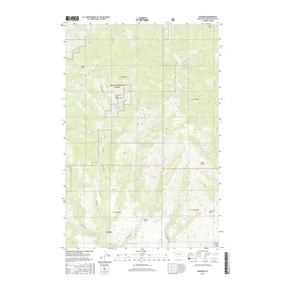
2017 Map of Wilborn
USGS Topo · Published 2017About this map
The tiny settlement of Wilborn serves as a geographic anchor in this high-altitude landscape within the Helena National Forest. Positioned near the intersection of Lincoln Rd W, Old Toll Rd, and Stemple Pass Rd, the area's development is clearly defined by its historical transportation routes through the Lewis and Clark Range. The map reveals a drainage system marked by steep gulches such as Bear Gulch, Miners Gulch, and Sawmill Gulch, many of which feed into watercourses like Big Mill Cr and Little Mill Cr. The presence of the Flesher Pass on the western edge of the quadrangle highlights the importance of mountain crossings in this part of Montana. For local historians and geographers, the map provides a look at the transition between dense forest and the valley bottoms shaped by Wilborn Cr and Rattlesnake Cr.
Find a feature on this map
32 named features on this map. Tap any name to fly to it.
Don’t see what you’re looking for? This feature index may not catch every label — zoom into the map to look around manually.
Map Details
Editions of this 2017 Wilborn Map
This is the sole edition of this map. No revisions or reprints were ever made.
Other maps of this area

1889 · Helena
USGS Topo · 1:250,000

1893 · Helena
USGS Topo · 1:250,000

1899 · Helena
USGS Topo · 1:250,000

1903 · Helena
USGS Topo · 1:250,000

1943 · Hogan
USGS Topo · 1:125,000

1947 · Butte
USGS Topo · 1:250,000

1955 · Choteau
USGS Topo · 1:250,000

1957 · Choteau
USGS Topo · 1:250,000

1958 · Butte
USGS Topo · 1:250,000

1958 · Choteau
USGS Topo · 1:250,000