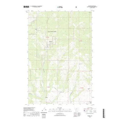
2020 Map of Wilborn
USGS Topo · Published 2020About this map
The high mountain crest of the Lewis and Clark Range dominates this landscape within the Helena National Forest, where the Continental Divide National Scenic Trail winds along the drainage divides. The settlement of Wilborn sits at the convergence of several historic routes, including Stemple Pass Rd and Old Toll Rd, reflecting the area's legacy as a transit point through the northern Rockies. The terrain is deeply incised by drainages such as Miners Gulch, Sawmill Gulch, and Glen Marie Gulch, names that hint at the region's historical extractive industries. Steep grades are negotiated by the winding Flesher Pass Rd, which leads toward the notable Flesher Pass in the northwest. Water features like Little Mill Cr and Virginia Cr flow through the valleys, marking the complex hydrology of the western Montana wilderness.
Find a feature on this map
34 named features on this map. Tap any name to fly to it.
Don’t see what you’re looking for? This feature index may not catch every label — zoom into the map to look around manually.
Map Details
Editions of this 2020 Wilborn Map
This is the sole edition of this map. No revisions or reprints were ever made.
Other maps of this area

1889 · Helena
USGS Topo · 1:250,000

1893 · Helena
USGS Topo · 1:250,000

1899 · Helena
USGS Topo · 1:250,000

1903 · Helena
USGS Topo · 1:250,000

1943 · Hogan
USGS Topo · 1:125,000

1947 · Butte
USGS Topo · 1:250,000

1955 · Choteau
USGS Topo · 1:250,000

1957 · Choteau
USGS Topo · 1:250,000

1958 · Butte
USGS Topo · 1:250,000

1958 · Choteau
USGS Topo · 1:250,000