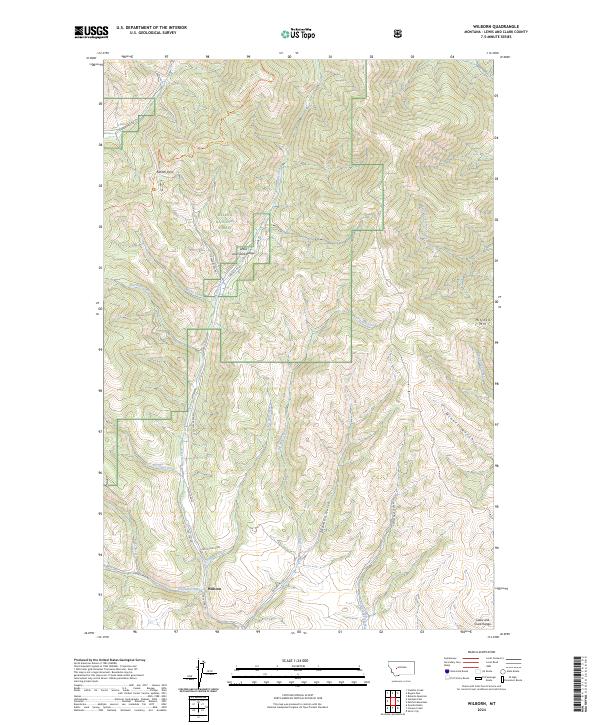
2024 Map of Wilborn
USGS Topo · Published 2024About this map
Wilborn sits at the base of the Lewis and Clark Range in this high-altitude mapping of Lewis and Clark County. The landscape is defined by the Continental Divide National Scenic Trl tracing the ridgeline through Flesher Pass, where Flesher Pass Rd crosses the divide. This area within the Helena National Forest is characterized by a dense network of gulches and creeks, such as Sawmill Gulch and Miners Gulch, which drain toward larger water bodies like Canyon Creek and Big Mill Creek. The presence of roads like Old Toll Rd and Kettle Gulch Rd suggests a history of transit and resource extraction through these mountain corridors. The terrain transitions from the peak of Mitchell Mtn down into narrow valleys like those of Virginia Creek and Trout Creek, illustrating the complex drainage patterns of the northern Rockies.
Find a feature on this map
33 named features on this map. Tap any name to fly to it.
Don’t see what you’re looking for? This feature index may not catch every label — zoom into the map to look around manually.
Map Details
Editions of this 2024 Wilborn Map
This is the sole edition of this map. No revisions or reprints were ever made.
Other maps of this area

1889 · Helena
USGS Topo · 1:250,000

1893 · Helena
USGS Topo · 1:250,000

1899 · Helena
USGS Topo · 1:250,000

1903 · Helena
USGS Topo · 1:250,000

1943 · Hogan
USGS Topo · 1:125,000

1947 · Butte
USGS Topo · 1:250,000

1955 · Choteau
USGS Topo · 1:250,000

1957 · Choteau
USGS Topo · 1:250,000

1958 · Butte
USGS Topo · 1:250,000

1958 · Choteau
USGS Topo · 1:250,000