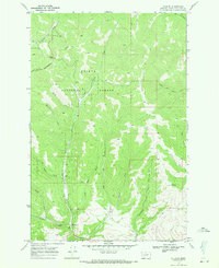
1968 Map of Wilborn
USGS Topo · Published 1971About this map
The Continental Divide defines the western high ground of this landscape, where the Flesher Pass Trail crosses through Flesher Pass. This 1968 field-checked map captures the remote character of the Helena National Forest in Lewis and Clark County, focusing on the small settlement of Wilborn situated at the confluence of several mountain drainages. The area is defined by a complex network of narrow gulches and creeks, including Miners Gulch and Sawmill Gulch, which suggest the historic resource extraction that once shaped these valleys. Numerous Prospects are scattered across the terrain, particularly in the northern reaches, while a series of Jeep Trails provide the primary access through the steep canyon floors of Canyon Creek and Rattlesnake Creek. This survey provides a precise view of the topography before modern development reached these high-elevation Montana drainages.
Find a feature on this map
26 named features on this map. Tap any name to fly to it.
Don’t see what you’re looking for? This feature index may not catch every label — zoom into the map to look around manually.
Map Details
Editions of this 1968 Wilborn Map
This is the sole edition of this map. No revisions or reprints were ever made.
Other maps of this area

1889 · Helena
USGS Topo · 1:250,000

1893 · Helena
USGS Topo · 1:250,000

1899 · Helena
USGS Topo · 1:250,000

1903 · Helena
USGS Topo · 1:250,000

1943 · Hogan
USGS Topo · 1:125,000

1947 · Butte
USGS Topo · 1:250,000

1955 · Choteau
USGS Topo · 1:250,000

1957 · Choteau
USGS Topo · 1:250,000

1958 · Butte
USGS Topo · 1:250,000

1958 · Choteau
USGS Topo · 1:250,000