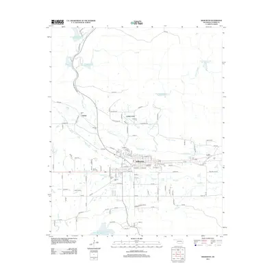
2013 Map of Wilburton
USGS Topo · Published 2013About this map
Wilburton serves as the central hub of this eastern Oklahoma landscape, positioned where the valley of Fourche Maline meets the local transportation network. The area's communal and family history is anchored by an extensive collection of burial grounds, including the Wilburton Cem, Masonic Cem, and the Sacred Heart Cem. To the north, Robbers Cave State Park encompasses the waters of Lake Carlton and several reservoirs along the creek, such as Fourche Maline Creek Site 4 Reservoir. Smaller settlements like Degnan, Center Point, and Lutie dot the outskirts, connected by a dense grid of rural routes. The presence of 21 Mine Rd points to the region's industrial past, while aviation facilities like Austin Airport and Parks Airport mark the modern infrastructure of the early 21st century.
Find a feature on this map
117 named features on this map. Tap any name to fly to it.
Don’t see what you’re looking for? This feature index may not catch every label — zoom into the map to look around manually.
Map Details
Editions of this 2013 Wilburton Map
This is the sole edition of this map. No revisions or reprints were ever made.
Other maps of this area

1900 · Sansbois
USGS Topo · 1:125,000

1901 · Tuskahoma
USGS Topo · 1:125,000

1908 · Tuskahoma
USGS Topo · 1:125,000

1909 · Tuskahoma
USGS Topo · 1:125,000

1909 · Sans Bois
USGS Topo · 1:125,000

1911 · Sansbois
USGS Topo · 1:125,000

1940 · Red Oak
USGS Topo · 1:62,500

1943 · Red Oak
USGS Topo · 1:62,500

1946 · Fort Smith
USGS Topo · 1:250,000

1950 · Mcalester
USGS Topo · 1:250,000