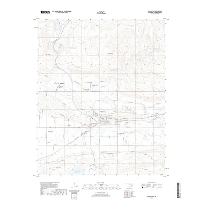
2018 Map of Wilburton
USGS Topo · Published 2018About this map
Wilburton serves as the central hub of this Latimer County landscape, where the valley of Fourche Maline divides the northern highlands from the prominent ridge of Blue Mtn. The town’s history is etched into its numerous burial grounds, including the Masonic Cem, Wilburton Cem, and Sacred Heart Cem, suggesting a long-standing community with diverse denominational roots. To the east, the settlement of Lutie sits near Lutie Cem, while the northern reaches transition into the foothills where Coon Cr and Cunneo Tubby Cr drain toward a series of water management sites like Fourche Maline Cr Site 2 Reservoir. Transportation and infrastructure are evidenced by Parks Airport and a grid of local routes like Degnan Rd and Centerpoint Rd, connecting the outlying areas of Degnan and Center Point to the valley floor.
Find a feature on this map
104 named features on this map. Tap any name to fly to it.
Don’t see what you’re looking for? This feature index may not catch every label — zoom into the map to look around manually.
Map Details
Editions of this 2018 Wilburton Map
This is the sole edition of this map. No revisions or reprints were ever made.
Other maps of this area

1900 · Sansbois
USGS Topo · 1:125,000

1901 · Tuskahoma
USGS Topo · 1:125,000

1908 · Tuskahoma
USGS Topo · 1:125,000

1909 · Tuskahoma
USGS Topo · 1:125,000

1909 · Sans Bois
USGS Topo · 1:125,000

1911 · Sansbois
USGS Topo · 1:125,000

1940 · Red Oak
USGS Topo · 1:62,500

1943 · Red Oak
USGS Topo · 1:62,500

1946 · Fort Smith
USGS Topo · 1:250,000

1950 · Mcalester
USGS Topo · 1:250,000