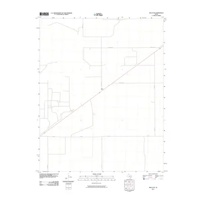
2010 Map of Wilco NE
USGS Topo · Published 2010About this map
Irwin stands as the central point of reference in this corner of the Texas Panhandle, situated along a primary diagonal thoroughfare. The landscape is defined by a rigorous grid of section lines and rural roads, typical of the high plains agricultural region in Dallam County. Transport and access are dictated by a network of ranch-to-market roads, including Fm 3212 and Ranch Rd 3213, which facilitate movement across the wide-open terrain. Local naming conventions are evident in smaller routes such as Cedar Post Ln and Steve Rd, while larger thoroughfares like Rock Hill Rd and Corbitt Rd anchor the survey. This 2010 edition by the U.S. Geological Survey uses NAIP imagery from 2008 to illustrate a landscape where the surveyor’s geometry remains the dominant organizing principle for settlement and travel.
Find a feature on this map
8 named features on this map. Tap any name to fly to it.
Don’t see what you’re looking for? This feature index may not catch every label — zoom into the map to look around manually.
Map Details
Editions of this 2010 Wilco NE Map
This is the sole edition of this map. No revisions or reprints were ever made.
Other maps of this area

1954 · Dalhart
USGS Topo · 1:250,000

1958 · Dalhart
USGS Topo · 1:250,000

1962 · Dalhart
USGS Topo · 1:250,000

1964 · Brickel
USGS Topo · 1:24,000

1964 · Stratford 2 SE
USGS Topo · 1:24,000

1965 · Wilco
USGS Topo · 1:24,000

1965 · Conlen
USGS Topo · 1:24,000

1965 · Wilco NE
USGS Topo · 1:24,000
1965 · Exum
USGS Topo · 1:24,000
1973 · Dalhart East
USGS Topo · 1:24,000