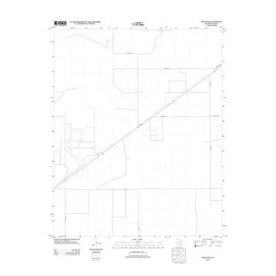
2012 Map of Wilco NE
USGS Topo · Published 2012About this map
Irwin stands as the central point of interest in this section of Dallam County, located along a straight transit corridor in the high plains of the Texas Panhandle. The landscape is defined by a rigid grid of rural roads and large-scale agricultural partitions, characteristic of the region's late 20th and early 21st-century land management. This survey illustrates the primary transportation arteries that sustain the local ranching economy, including FM-3212 and Ranch Road 3213. Family-named routes such as Crabtree Ln and Corbitt Rd intersect the northern and eastern portions of the map, while Rock Hill Rd and Cedar Post Ln provide access to the expansive open terrain. The mapping focuses on the functional infrastructure of the plains, where long-distance sightlines and deliberate road placements reflect the vast scale of Northwest Texas cattle and farming operations.
Find a feature on this map
9 named features on this map. Tap any name to fly to it.
Don’t see what you’re looking for? This feature index may not catch every label — zoom into the map to look around manually.
Map Details
Editions of this 2012 Wilco NE Map
This is the sole edition of this map. No revisions or reprints were ever made.
Other maps of this area

1954 · Dalhart
USGS Topo · 1:250,000

1958 · Dalhart
USGS Topo · 1:250,000

1962 · Dalhart
USGS Topo · 1:250,000

1964 · Brickel
USGS Topo · 1:24,000

1964 · Stratford 2 SE
USGS Topo · 1:24,000

1965 · Wilco
USGS Topo · 1:24,000

1965 · Conlen
USGS Topo · 1:24,000

1965 · Wilco NE
USGS Topo · 1:24,000
1965 · Exum
USGS Topo · 1:24,000
1973 · Dalhart East
USGS Topo · 1:24,000