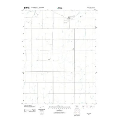
2011 Map of Wilcox
USGS Topo · Published 2011About this map
Wilcox serves as the central hub for this portion of Kearney County, a landscape defined by its grid of sectional roads and the winding paths of local waterways. The town's layout is documented in detail, featuring the Wilcox Post Office and a network of streets including S Main St. The surrounding countryside reveals a history of early Nebraska settlement through its widely distributed burying grounds, including Wilcox Cemetery to the north, Saint Johns Cemetery further south, and the Freewater Cemetery near the western boundary. These sites, often positioned away from the primary town center, reflect the rural community structure of the early 21st century. Natural drainage for the agricultural terrain is provided by the various branches of Center Creek, which meanders across the central and southern sections, along with Sacramento Creek and the West Branch Thompson Creek.
Find a feature on this map
17 named features on this map. Tap any name to fly to it.
Don’t see what you’re looking for? This feature index may not catch every label — zoom into the map to look around manually.
Map Details
Editions of this 2011 Wilcox Map
This is the sole edition of this map. No revisions or reprints were ever made.
Other maps of this area

1896 · Holdrege
USGS Topo · 1:125,000

1955 · Grand Island
USGS Topo · 1:250,000

1957 · Grand Island
USGS Topo · 1:250,000

1958 · Grand Island
USGS Topo · 1:250,000

1970 · Holdrege East
USGS Topo · 1:24,000

1970 · Axtell West
USGS Topo · 1:24,000
1970 · Axtell East
USGS Topo · 1:24,000

1970 · Wilcox
USGS Topo · 1:24,000

1970 · Ragan
USGS Topo · 1:24,000
1970 · Hildreth
USGS Topo · 1:24,000