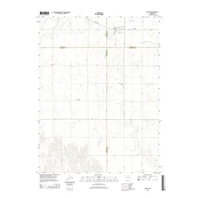
2014 Map of Wilcox
USGS Topo · Published 2014About this map
The village of Wilcox serves as the primary hub in this portion of the Nebraska plains, where the convergence of Phelps, Kearney, Harlan, and Franklin counties creates a unique intersection of local jurisdictions. This agricultural landscape is meticulously organized by a grid of section roads including Polyline Rd, 727 Rd, and A Rd, reflecting the long-term patterns of rural land division in the region. The drainage of the land is defined by several watercourses, most notably Center Creek and the West Branch Thompson Creek, which carve subtle paths through the terrain.
Find a feature on this map
27 named features on this map. Tap any name to fly to it.
Don’t see what you’re looking for? This feature index may not catch every label — zoom into the map to look around manually.
Map Details
Editions of this 2014 Wilcox Map
This is the sole edition of this map. No revisions or reprints were ever made.
Other maps of this area

1896 · Holdrege
USGS Topo · 1:125,000

1955 · Grand Island
USGS Topo · 1:250,000

1957 · Grand Island
USGS Topo · 1:250,000

1958 · Grand Island
USGS Topo · 1:250,000

1970 · Holdrege East
USGS Topo · 1:24,000

1970 · Axtell West
USGS Topo · 1:24,000
1970 · Axtell East
USGS Topo · 1:24,000

1970 · Wilcox
USGS Topo · 1:24,000

1970 · Ragan
USGS Topo · 1:24,000
1970 · Hildreth
USGS Topo · 1:24,000