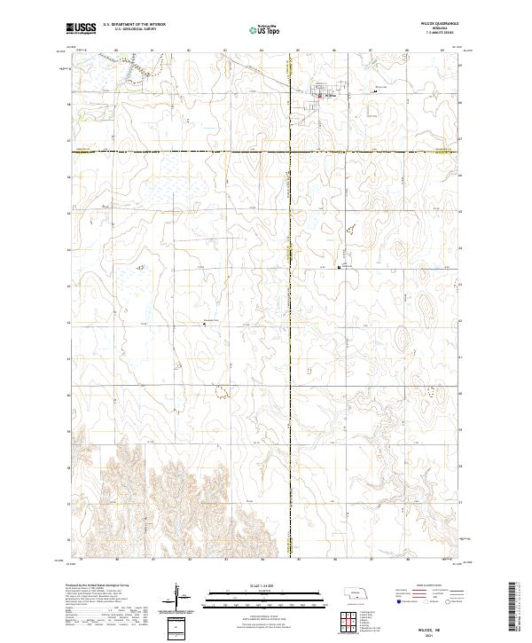
2021 Map of Wilcox
USGS Topo · Published 2021About this map
Wilcox serves as the primary hub of this landscape, situated at the intersection of S Main St and Sapp St. The village is surrounded by a sprawling grid of section roads that cross the drainage basins of Sacramento Cr and Center Cr. This 2021 survey highlights the jurisdictional convergence of four counties: Phelps Co, Kearney Co, Harlan Co, and Franklin Co, with roads like Franklin Harlan Rd following the historical political boundaries. Genealogists can locate several burial grounds in the outlying rural areas, including Wilcox Cem to the east of town, Freewater Cem to the southwest, and Saint Johns Cem near 21st Rd. The map illustrates a modern agricultural region defined by precision section lines and intermittent waterways.
Find a feature on this map
45 named features on this map. Tap any name to fly to it.
Don’t see what you’re looking for? This feature index may not catch every label — zoom into the map to look around manually.
Map Details
Editions of this 2021 Wilcox Map
This is the sole edition of this map. No revisions or reprints were ever made.
Other maps of this area

1896 · Holdrege
USGS Topo · 1:125,000

1955 · Grand Island
USGS Topo · 1:250,000

1957 · Grand Island
USGS Topo · 1:250,000

1958 · Grand Island
USGS Topo · 1:250,000

1970 · Holdrege East
USGS Topo · 1:24,000

1970 · Axtell West
USGS Topo · 1:24,000
1970 · Axtell East
USGS Topo · 1:24,000

1970 · Wilcox
USGS Topo · 1:24,000

1970 · Ragan
USGS Topo · 1:24,000
1970 · Hildreth
USGS Topo · 1:24,000