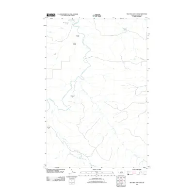
2011 Map of Wild Bill Flat East
USGS Topo · Published 2011About this map
The Judith River carves a winding path through this portion of Fergus County, defining a landscape of high plateaus and deeply eroded drainages. The terrain is characterized by expansive level areas such as Wild Bill Flat and Whitaker Flat, which contrast with the intricate network of coulees that feed into the main river valley. Numerous seasonal waterways, including Plum Creek and Box Elder Creek, have etched significant relief into the earth, creating natural corridors through the rangeland.
Find a feature on this map
14 named features on this map. Tap any name to fly to it.
Don’t see what you’re looking for? This feature index may not catch every label — zoom into the map to look around manually.
Map Details
Editions of this 2011 Wild Bill Flat East Map
This is the sole edition of this map. No revisions or reprints were ever made.
Other maps of this area

1954 · Lewistown
USGS Topo · 1:250,000

1959 · Lewistown
USGS Topo · 1:250,000

1964 · Wolf Creek Falls
USGS Topo · 1:24,000

1964 · Anderson Bridge
USGS Topo · 1:24,000

1978 · Wild Bill Flat West
USGS Topo · 1:24,000

1978 · Toney Bench
USGS Topo · 1:24,000

1978 · Seventytwo Hills
USGS Topo · 1:24,000

1978 · Wild Bill Flat East
USGS Topo · 1:24,000

1978 · Lewistown
USGS Topo · 1:100,000
1985 · Hilger NW
USGS Topo · 1:24,000