
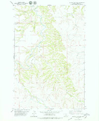
1978 Map of Wild Bill Flat East
USGS Topo · Published 1979About this map
The Judith River winds through this Fergus County landscape, carving a deep corridor between the high, level benches of Wild Bill Flat and Whitaker Flat. This 1970s survey captures a territory defined by its complex drainage network, where numerous coulees—including Bear Coulee, Gilkey Coulee, and Threemile Coulee—descend from the surrounding breaks to meet the river. The presence of Landing Strips and a remote Landing Strip suggests the logistical realities of managing such large, isolated ranching tracts. Water remains the primary focal point of the area's geography, evidenced by features like Bear Springs, Plum Creek, and the long reach of Box Elder Creek, which together illustrate the vital importance of natural springs and seasonal flows in this semi-arid Montana environment.
Find a feature on this map
17 named features on this map. Tap any name to fly to it.
Don’t see what you’re looking for? This feature index may not catch every label — zoom into the map to look around manually.
Map Details
Editions of this 1978 Wild Bill Flat East Map
2 editions found
Other maps of this area

1954 · Lewistown
USGS Topo · 1:250,000

1959 · Lewistown
USGS Topo · 1:250,000

1964 · Wolf Creek Falls
USGS Topo · 1:24,000

1964 · Anderson Bridge
USGS Topo · 1:24,000

1978 · Wild Bill Flat West
USGS Topo · 1:24,000

1978 · Toney Bench
USGS Topo · 1:24,000

1978 · Seventytwo Hills
USGS Topo · 1:24,000

1978 · Lewistown
USGS Topo · 1:100,000
1985 · Hilger NW
USGS Topo · 1:24,000
1985 · Kendall
USGS Topo · 1:24,000