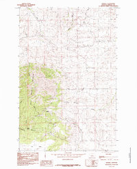
1985 Map of Kendall
USGS Topo · Published 1985About this map
Kendall sits at the foot of the eastern slopes of the North Moccasin Mountains, serving as a central point of interest in this Fergus County landscape. The terrain is defined by a series of deep drainage patterns, most notably Mason Canyon and Sennett Canyon, which carve through the high ground towards the valley floors. Water distribution is key to the area's character, with multiple tributaries like Box Elder Creek and Last Chance Creek illustrating the watershed's complexity.
Find a feature on this map
16 named features on this map. Tap any name to fly to it.
Don’t see what you’re looking for? This feature index may not catch every label — zoom into the map to look around manually.
Map Details
Editions of this 1985 Kendall Map
This is the sole edition of this map. No revisions or reprints were ever made.
Other maps of this area

1941 · Lewistown
USGS Topo · 1:62,500

1944 · Lewistown
USGS Topo · 1:62,500

1954 · Lewistown
USGS Topo · 1:250,000

1959 · Lewistown
USGS Topo · 1:250,000

1970 · Spring Creek Junction
USGS Topo · 1:24,000

1978 · Seventytwo Hills
USGS Topo · 1:24,000

1978 · Wild Bill Flat East
USGS Topo · 1:24,000

1978 · Lewistown
USGS Topo · 1:100,000
1985 · Hilger NW
USGS Topo · 1:24,000

1985 · Hilger
USGS Topo · 1:24,000