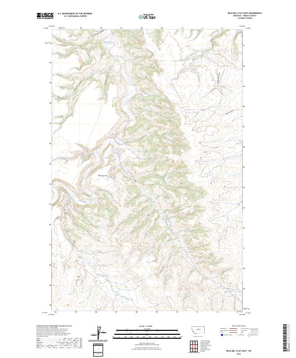
2024 Map of Wild Bill Flat East
USGS Topo · Published 2024About this map
Bear Springs serves as a lone named settlement in this drainage-rich portion of Fergus County, where the Judith River winds northward through a deeply incised landscape. The terrain is defined by a series of parallel drainage systems, including Fivemile Coulee, Gilkey Coulee, and Threemile Coulee, all contributing to the larger river basin. Broad elevated benches like Whitaker Flat provide a topographical contrast to the winding creek beds of Box Elder Creek and Plum Creek. This modern survey by the U.S. Geological Survey details the contemporary rural infrastructure of the region, where sparsely placed routes like 3 Mile Rd and Balky Horse Rd traverse the breaks and coulees. The map's layout of township and range lines reveals the enduring cadastral framework that has governed land use in central Montana since the initial homesteading era.
Find a feature on this map
15 named features on this map. Tap any name to fly to it.
Don’t see what you’re looking for? This feature index may not catch every label — zoom into the map to look around manually.
Map Details
Editions of this 2024 Wild Bill Flat East Map
This is the sole edition of this map. No revisions or reprints were ever made.
Other maps of this area

1954 · Lewistown
USGS Topo · 1:250,000

1959 · Lewistown
USGS Topo · 1:250,000

1964 · Wolf Creek Falls
USGS Topo · 1:24,000

1964 · Anderson Bridge
USGS Topo · 1:24,000

1978 · Wild Bill Flat West
USGS Topo · 1:24,000

1978 · Toney Bench
USGS Topo · 1:24,000

1978 · Seventytwo Hills
USGS Topo · 1:24,000

1978 · Wild Bill Flat East
USGS Topo · 1:24,000

1978 · Lewistown
USGS Topo · 1:100,000
1985 · Hilger NW
USGS Topo · 1:24,000