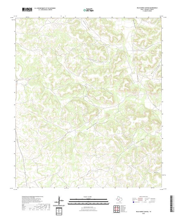
2022 Map of Wild Horse Canyon
USGS Topo · Published 2022About this map
Wild Horse Canyon and its network of ephemeral drainage draws define this segment of the West Texas landscape in Crockett County. The terrain is marked by a complex system of deep incisions, including Shaggy Canyon and Little Shaggy Canyon, which demonstrate the natural erosional patterns characteristic of this arid region. Human imprint on the land is sparse, primarily restricted to rural transit corridors such as Taylor Box Rd, which provides access through the high plateaus between the draws. This 2022 survey captures the modern ranching environment where water management and topography dictate the placement of local infrastructure. Significant features like Jesus Draw and Bull Clod Draw remain central landmarks for orientation in a territory defined by its repeating ridges and dry creek beds.
Find a feature on this map
8 named features on this map. Tap any name to fly to it.
Don’t see what you’re looking for? This feature index may not catch every label — zoom into the map to look around manually.
Map Details
Editions of this 2022 Wild Horse Canyon Map
This is the sole edition of this map. No revisions or reprints were ever made.
Other maps of this area

1954 · Sonora
USGS Topo · 1:250,000

1958 · Sonora
USGS Topo · 1:250,000

1967 · Baggett Ranch
USGS Topo · 1:24,000

1967 · Flat Rock Draw SW
USGS Topo · 1:24,000

1967 · Ozona SE
USGS Topo · 1:24,000

1967 · Shafter Draw
USGS Topo · 1:24,000
1967 · Hospital Ranch
USGS Topo · 1:24,000

1969 · Wild Horse Canyon
USGS Topo · 1:24,000

1970 · Indian Draw
USGS Topo · 1:24,000

1970 · Brushy Draw
USGS Topo · 1:24,000