
1967 Map of Ozona SE
USGS Topo · Published 1970About this map
Crockett County ranching life is clearly defined by the intricate network of canyons and dry washes that crisscross this West Texas landscape. Named homesteads like Read Ranch and Perner Ranch anchor the territory, suggesting the importance of localized water sources and family operations in this semi-arid environment. The terrain is dominated by steep-sided drainages including Shaggy Canyon, Plum Canyon, and the curiously named Rock House Canyon, which along with several draws like Baggett Draw and Tucker Draw, shape the movement of people and livestock.
Find a feature on this map
21 named features on this map. Tap any name to fly to it.
Don’t see what you’re looking for? This feature index may not catch every label — zoom into the map to look around manually.
Map Details
Editions of this 1967 Ozona SE Map
2 editions found
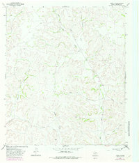
Other maps of this area

1954 · Sonora
USGS Topo · 1:250,000

1958 · Sonora
USGS Topo · 1:250,000

1967 · Nolen Draw
USGS Topo · 1:24,000

1967 · Ozona
USGS Topo · 1:24,000

1967 · Baggett Ranch
USGS Topo · 1:24,000

1967 · Shafter Draw
USGS Topo · 1:24,000

1967 · Crockett Heights
USGS Topo · 1:24,000
1967 · Hospital Ranch
USGS Topo · 1:24,000

1969 · Wild Horse Canyon
USGS Topo · 1:24,000
1970 · Harrell Canyon
USGS Topo · 1:24,000