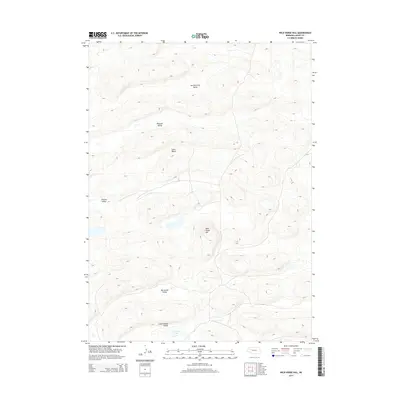
2014 Map of Wild Horse Hill
USGS Topo · Published 2014About this map
Wild Horse Hill rises as a central landmark amidst the expansive sandhills of Grant County in this 2014 survey. The landscape is defined by a series of prominent depressions and drainage basins, most notably the broad Van Nortwick Valley to the north and the cluster of southern basins including Big Swede Valley and Little Swede Valley. These features indicate the unique hydrology of the region, where seasonal water accumulation is centered on points like Swede Lake. The map reveals a sparsely populated terrain characterized by isolated valleys such as Pleasant Valley and Juten Valley, which likely served as focal points for local ranching operations and water access in an otherwise arid environment. This contemporary record captures the enduring topography of the Nebraska Sandhills before further modern development or environmental shifts.
Find a feature on this map
8 named features on this map. Tap any name to fly to it.
Don’t see what you’re looking for? This feature index may not catch every label — zoom into the map to look around manually.
Map Details
Editions of this 2014 Wild Horse Hill Map
This is the sole edition of this map. No revisions or reprints were ever made.
Other maps of this area

1948 · Ashby
USGS Topo · 1:62,500

1948 · Bingham
USGS Topo · 1:62,500

1948 · George Lake
USGS Topo · 1:62,500

1949 · Ashby
USGS Topo · 1:62,500

1950 · George Lake
USGS Topo · 1:62,500

1950 · Longfellow Lake
USGS Topo · 1:62,500

1950 · Bingham
USGS Topo · 1:62,500

1954 · Scottsbluff
USGS Topo · 1:250,000

1954 · North Platte
USGS Topo · 1:250,000

1955 · Alliance
USGS Topo · 1:250,000