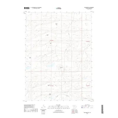
2017 Map of Wild Horse Hill
USGS Topo · Published 2017About this map
Wild Horse Hill rises above a landscape of high Nebraska dunes and interdunal valleys in this 2017 study of Grant County. The map details a complex system of internal drainages and wet meadows characteristic of the Sandhills, including Swede Lake and the surrounding Big Swede Valley and Little Swede Valley. This region is defined by its topographic isolation, where named depressions like Van Nortwick Valley, Pleasant Valley, Juten Valley, and Kramer Valley provided the essential level ground for ranching operations and early transport routes.
Find a feature on this map
18 named features on this map. Tap any name to fly to it.
Don’t see what you’re looking for? This feature index may not catch every label — zoom into the map to look around manually.
Map Details
Editions of this 2017 Wild Horse Hill Map
This is the sole edition of this map. No revisions or reprints were ever made.
Other maps of this area

1948 · Ashby
USGS Topo · 1:62,500

1948 · Bingham
USGS Topo · 1:62,500

1948 · George Lake
USGS Topo · 1:62,500

1949 · Ashby
USGS Topo · 1:62,500

1950 · George Lake
USGS Topo · 1:62,500

1950 · Longfellow Lake
USGS Topo · 1:62,500

1950 · Bingham
USGS Topo · 1:62,500

1954 · Scottsbluff
USGS Topo · 1:250,000

1954 · North Platte
USGS Topo · 1:250,000

1955 · Alliance
USGS Topo · 1:250,000