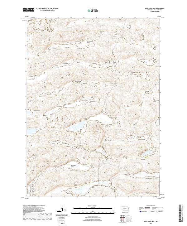
2021 Map of Wild Horse Hill
USGS Topo · Published 2021About this map
Wild Horse Hill rises above the rhythmic dune formations of the Nebraska Sandhills, serving as the central landmark for this Grant County landscape. The area is defined by a series of northwest-to-southeast trending depressions, including Larkin Valley, Van Nortwick Valley, and Pleasant Valley, which reflect the unique geomorphology of this cattle-ranching region. Unlike more developed areas, the human footprint here consists primarily of named ranch roads and lanes, such as S Ashby Rd and Burgess Ln, which navigate the interdunal valleys.
Find a feature on this map
19 named features on this map. Tap any name to fly to it.
Don’t see what you’re looking for? This feature index may not catch every label — zoom into the map to look around manually.
Map Details
Editions of this 2021 Wild Horse Hill Map
This is the sole edition of this map. No revisions or reprints were ever made.
Other maps of this area

1948 · Ashby
USGS Topo · 1:62,500

1948 · Bingham
USGS Topo · 1:62,500

1948 · George Lake
USGS Topo · 1:62,500

1949 · Ashby
USGS Topo · 1:62,500

1950 · George Lake
USGS Topo · 1:62,500

1950 · Longfellow Lake
USGS Topo · 1:62,500

1950 · Bingham
USGS Topo · 1:62,500

1954 · Scottsbluff
USGS Topo · 1:250,000

1954 · North Platte
USGS Topo · 1:250,000

1955 · Alliance
USGS Topo · 1:250,000