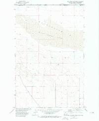
1972 Map of Wild Horse Lake West
USGS Topo · Published 1975About this map
Wild Horse Lake dominates this high plains landscape at the international boundary between Canada and the United States. The lake itself is noted as a massive depression, a characteristic feature of this arid borderlands region in Hill County. Historically significant routes traverse the prairie, including the Wild Horse Trail and the Amos Trail, which suggest the movement of livestock or goods across the open range. The presence of numerous Well sites and isolated storage bins reflects the area's reliance on groundwater and dryland agriculture during the early 1970s. This survey records a remote segment of the Montana and Alberta border, where the land-use patterns are dictated by the underlying topography and the availability of water in a vast, open territory.
Find a feature on this map
9 named features on this map. Tap any name to fly to it.
Don’t see what you’re looking for? This feature index may not catch every label — zoom into the map to look around manually.
Map Details
Editions of this 1972 Wild Horse Lake West Map
This is the sole edition of this map. No revisions or reprints were ever made.
Other maps of this area

1912 · Thibedeau Lake
USGS Topo · 1:125,000

1920 · Gildford
USGS Topo · 1:125,000

1943 · Gildford
USGS Topo · 1:125,000

1953 · Havre
USGS Topo · 1:250,000

1954 · Shelby
USGS Topo · 1:250,000

1957 · Havre
USGS Topo · 1:250,000

1958 · Shelby
USGS Topo · 1:250,000

1958 · Havre
USGS Topo · 1:250,000
1972 · Cottonwood
USGS Topo · 1:24,000
1972 · Ninemile Coulee East
USGS Topo · 1:24,000