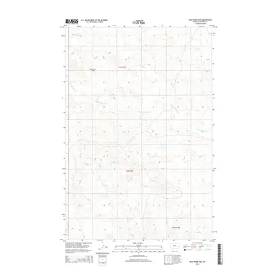
2014 Map of Wild Horse Pass
USGS Topo · Published 2014About this map
Wild Horse Pass serves as a prominent geographic landmark in this portion of Rosebud County, where the high-plains terrain is carved by a network of seasonal drainages. The landscape is defined by the headwaters of Louie and Scottie Cr and the northward-reaching fingers of Sand Cr. Further east, the topography transitions toward Kenney Coulee and E Fork Horse Cr. This 2014 survey documents the remote character of the region, emphasizing the natural drainage patterns and the Public Land Survey System grids of t10n r42e and t9n r42e that organized this part of Montana for ranching and land management. The absence of major settlements highlights the enduring isolation of this rural territory.
Find a feature on this map
7 named features on this map. Tap any name to fly to it.
Don’t see what you’re looking for? This feature index may not catch every label — zoom into the map to look around manually.
Map Details
Editions of this 2014 Wild Horse Pass Map
This is the sole edition of this map. No revisions or reprints were ever made.
Other maps of this area

1954 · Forsyth
USGS Topo · 1:250,000

1957 · Forsyth
USGS Topo · 1:250,000

1958 · Forsyth
USGS Topo · 1:250,000

1968 · Box Canyon Coulee
USGS Topo · 1:24,000

1968 · Sand Buttes
USGS Topo · 1:24,000

1968 · Schultz Coulee
USGS Topo · 1:24,000

1969 · Van Burton Creek
USGS Topo · 1:24,000

1969 · Wild Horse Pass SE
USGS Topo · 1:24,000

1969 · Wild Horse Pass
USGS Topo · 1:24,000
1969 · Alkali Creek
USGS Topo · 1:24,000