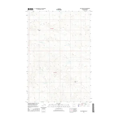
2017 Map of Wild Horse Pass
USGS Topo · Published 2017About this map
Wild Horse Pass centers this high-plains landscape in Rosebud County, where the terrain is defined by complex drainage systems and subtle elevation changes. The map documents a predominantly open territory within the township of t10n r42e and t9n r42e, characterized by deep-cut geographic features such as Kenney Coulee. Water sources are sparse but critical, represented here by the branching paths of Louie and Scottie Cr and Sand Cr. This 2017 survey reflects the modern management of this cattle-country landscape, where the public land survey system remains the primary method for organizing this vast, unpopulated stretch of eastern Montana.
Find a feature on this map
6 named features on this map. Tap any name to fly to it.
Don’t see what you’re looking for? This feature index may not catch every label — zoom into the map to look around manually.
Map Details
Editions of this 2017 Wild Horse Pass Map
This is the sole edition of this map. No revisions or reprints were ever made.
Other maps of this area

1954 · Forsyth
USGS Topo · 1:250,000

1957 · Forsyth
USGS Topo · 1:250,000

1958 · Forsyth
USGS Topo · 1:250,000

1968 · Box Canyon Coulee
USGS Topo · 1:24,000

1968 · Sand Buttes
USGS Topo · 1:24,000

1968 · Schultz Coulee
USGS Topo · 1:24,000

1969 · Van Burton Creek
USGS Topo · 1:24,000

1969 · Wild Horse Pass SE
USGS Topo · 1:24,000

1969 · Wild Horse Pass
USGS Topo · 1:24,000
1969 · Alkali Creek
USGS Topo · 1:24,000