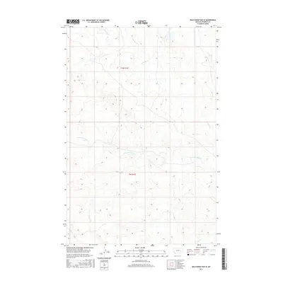
2017 Map of Wild Horse Pass SE
USGS Topo · Published 2017About this map
S Sunday Cr and its various tributaries define the drainage patterns across this section of Rosebud County, Montana. The terrain is characterized by a network of intermittent watercourses, including Louie and Scottie Cr and Lone Tree Cr, which cut through the land as it transitions between township boundaries t10n r43e and t9n r43e. Toward the southern edge of the survey, the landscape falls toward Coal Cr. This 2017 data captures a sparsely populated region of the northern plains, where the land is primarily organized by the Public Land Survey System rather than dense settlement. The map reveals the intricate contouring of the local coulees and ridges, illustrating the natural erosion patterns typical of this Montana landscape.
Find a feature on this map
6 named features on this map. Tap any name to fly to it.
Don’t see what you’re looking for? This feature index may not catch every label — zoom into the map to look around manually.
Map Details
Editions of this 2017 Wild Horse Pass SE Map
This is the sole edition of this map. No revisions or reprints were ever made.
Other maps of this area

1954 · Forsyth
USGS Topo · 1:250,000

1957 · Forsyth
USGS Topo · 1:250,000

1958 · Forsyth
USGS Topo · 1:250,000

1968 · Box Canyon Coulee
USGS Topo · 1:24,000

1968 · Sand Buttes
USGS Topo · 1:24,000

1968 · Hathaway NW
USGS Topo · 1:24,000

1969 · Van Burton Creek
USGS Topo · 1:24,000

1969 · Wild Horse Pass SE
USGS Topo · 1:24,000

1969 · Wild Horse Pass
USGS Topo · 1:24,000
1969 · Alkali Creek
USGS Topo · 1:24,000