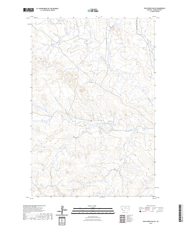
2024 Map of Wild Horse Pass SE
USGS Topo · Published 2024About this map
South Sunday Creek meanders through the drainages of Rosebud County, defining a landscape marked by intermittent watercourses and the geometric precision of the Public Land Survey System. This 2024 survey documents the remote terrain within townships t10n r42e, t10n r43e, t9n r42e, and t9n r43e, where the drainage patterns of Lone Tree Creek and the curiously named Louie and Scottie Creek indicate a complex network of seasonal flows. The topographic data reveals the subtle elevation changes characteristic of this portion of Montana, providing a clear record of the watershed near Coal Creek as it appeared in the early 21st century.
Find a feature on this map
8 named features on this map. Tap any name to fly to it.
Don’t see what you’re looking for? This feature index may not catch every label — zoom into the map to look around manually.
Map Details
Editions of this 2024 Wild Horse Pass SE Map
This is the sole edition of this map. No revisions or reprints were ever made.
Other maps of this area

1954 · Forsyth
USGS Topo · 1:250,000

1957 · Forsyth
USGS Topo · 1:250,000

1958 · Forsyth
USGS Topo · 1:250,000

1968 · Box Canyon Coulee
USGS Topo · 1:24,000

1968 · Sand Buttes
USGS Topo · 1:24,000

1968 · Hathaway NW
USGS Topo · 1:24,000

1969 · Van Burton Creek
USGS Topo · 1:24,000

1969 · Wild Horse Pass SE
USGS Topo · 1:24,000

1969 · Wild Horse Pass
USGS Topo · 1:24,000
1969 · Alkali Creek
USGS Topo · 1:24,000