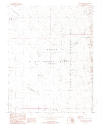
1988 Map of Wild Horse Ranch
USGS Topo · Published 1988About this map
Wild Horse Ranch serves as a lone point of habitation amidst the remote high-desert terrain of central Nye County during the late 1980s. This land is defined by its administrative boundaries and topography, specifically where the Wild Horse Nevada Management Area meets the northern reaches of the Nellis Air Force Range. To the east, the Kawich Range rises sharply, drained by the Wild Horse Draw, while the southwestern portion of the sheet is marked by a significant geomorphic Depression. Infrastructure here is primarily focused on military and utility operations, evidenced by several numbered sites like Site 54 and Site 52, a network of transmission lines, and various communication towers including Tower 110 Ft. Movement through this landscape is dictated by the Trailer Pass Road, which crosses the southern territory through Trailer Pass.
Find a feature on this map
26 named features on this map. Tap any name to fly to it.
Don’t see what you’re looking for? This feature index may not catch every label — zoom into the map to look around manually.
Map Details
Editions of this 1988 Wild Horse Ranch Map
This is the sole edition of this map. No revisions or reprints were ever made.
Other maps of this area

1908 · Kawich
USGS Topo · 1:250,000

1942 · Cactus Range
USGS Topo · 1:125,000

1942 · Reveille Peak
USGS Topo · 1:125,000

1952 · Stinking Spring
USGS Topo · 1:62,500

1952 · Mellan
USGS Topo · 1:62,500

1952 · Kawich Peak
USGS Topo · 1:62,500

1952 · Quartzite Mtn
USGS Topo · 1:62,500

1954 · Goldfield
USGS Topo · 1:250,000

1955 · Goldfield
USGS Topo · 1:250,000

1958 · Goldfield
USGS Topo · 1:250,000