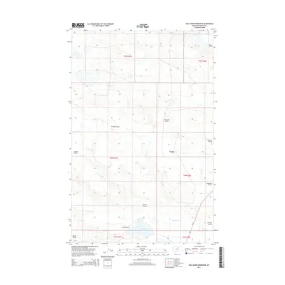
2014 Map of Wild Horse Reservoir
USGS Topo · Published 2014About this map
Wild Horse Reservoir anchors the southern portion of this landscape in Phillips County, reflecting the vital importance of water management in the northern Montana plains. The terrain is defined by a dense network of coulees that drain the surrounding high ground, including Tin Roof Coulee, Fourmile Coulee, and Threemile Coulee. These geographical features trace the natural path of runoff through the arid environment, where Wild Horse Cr and W Alkali Cr serve as primary watercourses. The presence of Us-191 provides a modern transportation link through this expanse of rangeland, following a corridor that has historically connected isolated ranching communities. The map highlights the intersection of several township and range boundaries, illustrating the systematic land division that governed settlement across the vast northern prairie.
Find a feature on this map
16 named features on this map. Tap any name to fly to it.
Don’t see what you’re looking for? This feature index may not catch every label — zoom into the map to look around manually.
Map Details
Editions of this 2014 Wild Horse Reservoir Map
This is the sole edition of this map. No revisions or reprints were ever made.
Other maps of this area

1953 · Havre
USGS Topo · 1:250,000

1957 · Havre
USGS Topo · 1:250,000

1958 · Havre
USGS Topo · 1:250,000

1964 · Coburg SE
USGS Topo · 1:24,000

1964 · Cow Creek
USGS Topo · 1:24,000

1965 · Wagner
USGS Topo · 1:24,000

1965 · West Alkali Reservoir
USGS Topo · 1:24,000

1965 · Phillips
USGS Topo · 1:24,000
1965 · Seymour Reservoir
USGS Topo · 1:24,000

1965 · Wild Horse Reservoir
USGS Topo · 1:24,000