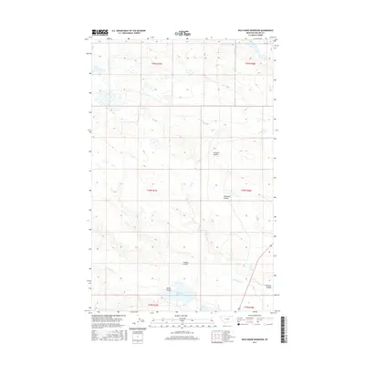
2017 Map of Wild Horse Reservoir
USGS Topo · Published 2017About this map
Wild Horse Reservoir anchors the southern reaches of this Montana landscape, where the drainage patterns of the high plains are defined by a complex network of seasonal coulees and creeks. The hydrology is dominated by the winding course of Wild Horse Cr and W Alkali Cr, which move through a terrain carved by numerous named draws. These landforms, such as Tin Roof Coulee and Tressler Coulee, reflect a geography where water management and topography dictate the use of the open range. The map illustrates a sparse, working landscape partitioned by the Public Land Survey System, including sections of t28n r27e and t28n r28e. This 2017 survey provides a precise accounting of the remote drainage systems and reservoirs essential to the region's ranching and water history.
Find a feature on this map
14 named features on this map. Tap any name to fly to it.
Don’t see what you’re looking for? This feature index may not catch every label — zoom into the map to look around manually.
Map Details
Editions of this 2017 Wild Horse Reservoir Map
This is the sole edition of this map. No revisions or reprints were ever made.
Other maps of this area

1953 · Havre
USGS Topo · 1:250,000

1957 · Havre
USGS Topo · 1:250,000

1958 · Havre
USGS Topo · 1:250,000

1964 · Coburg SE
USGS Topo · 1:24,000

1964 · Cow Creek
USGS Topo · 1:24,000

1965 · Wagner
USGS Topo · 1:24,000

1965 · West Alkali Reservoir
USGS Topo · 1:24,000

1965 · Phillips
USGS Topo · 1:24,000
1965 · Seymour Reservoir
USGS Topo · 1:24,000

1965 · Wild Horse Reservoir
USGS Topo · 1:24,000