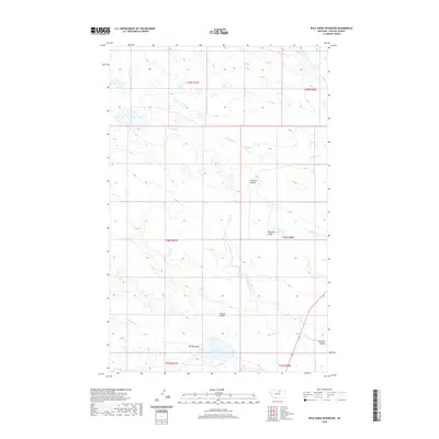
2020 Map of Wild Horse Reservoir
USGS Topo · Published 2020About this map
Wild Horse Reservoir serves as a central collection point for the drainage systems of northern Phillips County. This 2020 map documents the complex network of intermittent watercourses and land management boundaries in the high plains south of the Canadian border. The landscape is defined by its coulees—narrow, steep-walled drainage valleys—including Fourmile Coulee, Threemile Coulee, and Tressler Coulee. These features illustrate the natural erosional patterns that shape the regional terrain, feeding into larger systems like Wild Horse Cr and W Alkali Cr. The map provides a contemporary view of these remote ranchlands, showing how modern land surveys interact with longstanding topographical features like Spring Coulee and Tin Roof Coulee.
Find a feature on this map
14 named features on this map. Tap any name to fly to it.
Don’t see what you’re looking for? This feature index may not catch every label — zoom into the map to look around manually.
Map Details
Editions of this 2020 Wild Horse Reservoir Map
This is the sole edition of this map. No revisions or reprints were ever made.
Other maps of this area

1953 · Havre
USGS Topo · 1:250,000

1957 · Havre
USGS Topo · 1:250,000

1958 · Havre
USGS Topo · 1:250,000

1964 · Coburg SE
USGS Topo · 1:24,000

1964 · Cow Creek
USGS Topo · 1:24,000

1965 · Wagner
USGS Topo · 1:24,000

1965 · West Alkali Reservoir
USGS Topo · 1:24,000

1965 · Phillips
USGS Topo · 1:24,000
1965 · Seymour Reservoir
USGS Topo · 1:24,000

1965 · Wild Horse Reservoir
USGS Topo · 1:24,000