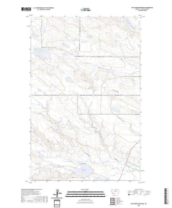
2024 Map of Wild Horse Reservoir
USGS Topo · Published 2024About this map
Wild Horse Reservoir anchors the southern reaches of this landscape in Phillips County, serving as a primary water source in a region defined by its complex drainage network. The terrain is deeply inscribed by numerous seasonal waterways, including Black Coulee in the northeast and a series of westward-flowing channels such as Threemile Coulee, Fourmile Coulee, and West Alkali Creek. These coulees illustrate the erosion patterns characteristic of the Montana plains, where water has carved distinct paths through the high prairie.
Find a feature on this map
16 named features on this map. Tap any name to fly to it.
Don’t see what you’re looking for? This feature index may not catch every label — zoom into the map to look around manually.
Map Details
Editions of this 2024 Wild Horse Reservoir Map
This is the sole edition of this map. No revisions or reprints were ever made.
Other maps of this area

1953 · Havre
USGS Topo · 1:250,000

1957 · Havre
USGS Topo · 1:250,000

1958 · Havre
USGS Topo · 1:250,000

1964 · Coburg SE
USGS Topo · 1:24,000

1964 · Cow Creek
USGS Topo · 1:24,000

1965 · Wagner
USGS Topo · 1:24,000

1965 · West Alkali Reservoir
USGS Topo · 1:24,000

1965 · Phillips
USGS Topo · 1:24,000
1965 · Seymour Reservoir
USGS Topo · 1:24,000

1965 · Wild Horse Reservoir
USGS Topo · 1:24,000