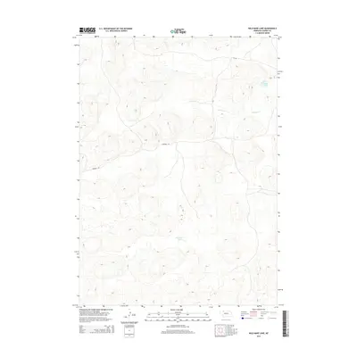
2014 Map of Wild Mare Lake
USGS Topo · Published 2014About this map
Wild Mare Lake defines the quiet, water-pocketed landscape of the Nebraska Sandhills within this section of Cherry County. The area is characterized by isolated basins and drainage patterns, including the winding course of Medicine Cr and the tucked-away Heath Lake. Local travel through this remote ranching country is centered around a few primary arteries, namely Eli Rd and Shadbolt Rd, which navigate the undulating terrain of the Nebraska backcountry. This 2014 survey captures a moment of topographical stability, illustrating how the region's hydrography and sparse road network remain deeply tied to the natural contours of the land.
Find a feature on this map
5 named features on this map. Tap any name to fly to it.
Don’t see what you’re looking for? This feature index may not catch every label — zoom into the map to look around manually.
Map Details
Editions of this 2014 Wild Mare Lake Map
This is the sole edition of this map. No revisions or reprints were ever made.
Other maps of this area

1950 · Doughboy
USGS Topo · 1:62,500

1951 · Merriman
USGS Topo · 1:62,500

1951 · Merriman 4
USGS Topo · 1:62,500

1952 · Eli
USGS Topo · 1:62,500

1952 · Doughboy
USGS Topo · 1:62,500

1957 · Valentine
USGS Topo · 1:250,000

1959 · Valentine
USGS Topo · 1:250,000

1985 · Cody
USGS Topo · 1:100,000
1985 · Eli SW
USGS Topo · 1:24,000
1985 · Medicine Lake
USGS Topo · 1:24,000