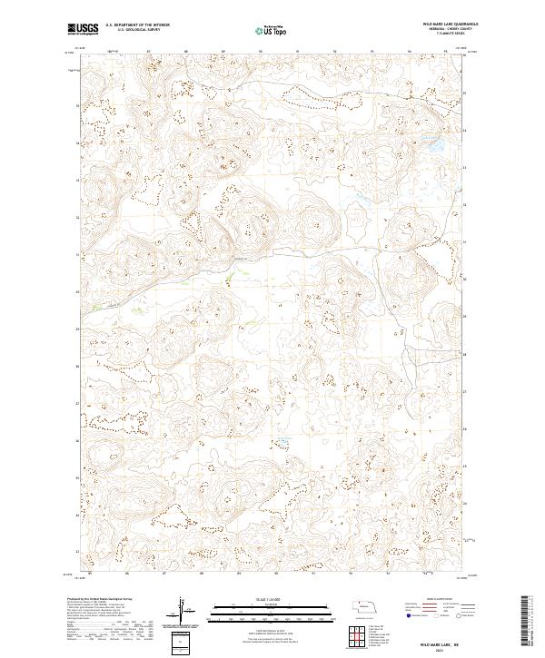
2021 Map of Wild Mare Lake
USGS Topo · Published 2021About this map
Wild Mare Lake sits at the heart of this sparsely populated portion of the Nebraska Sandhills, an area defined more by its natural hydrography and land survey boundaries than by any concentrated settlement. This 2021 record of the northern interior of Cherry County illustrates the characteristic undulating terrain through which Medicine Cr flows eastward. The landscape is marked by isolated water bodies like Heath Lake and a lone secondary thoroughfare, Shadbolt Rd, which provides the primary access through the surrounding range. The map clearly delineates the township and range divisions of T32N and T31N, which serve as the fundamental organizational structure for these sprawling ranchlands.
Find a feature on this map
8 named features on this map. Tap any name to fly to it.
Don’t see what you’re looking for? This feature index may not catch every label — zoom into the map to look around manually.
Map Details
Editions of this 2021 Wild Mare Lake Map
This is the sole edition of this map. No revisions or reprints were ever made.
Other maps of this area

1950 · Doughboy
USGS Topo · 1:62,500

1951 · Merriman
USGS Topo · 1:62,500

1951 · Merriman 4
USGS Topo · 1:62,500

1952 · Eli
USGS Topo · 1:62,500

1952 · Doughboy
USGS Topo · 1:62,500

1957 · Valentine
USGS Topo · 1:250,000

1959 · Valentine
USGS Topo · 1:250,000

1985 · Cody
USGS Topo · 1:100,000
1985 · Eli SW
USGS Topo · 1:24,000
1985 · Medicine Lake
USGS Topo · 1:24,000