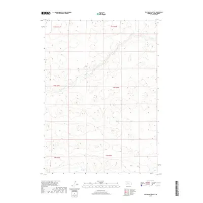
2017 Map of Wild Mare Lake SE
USGS Topo · Published 2017About this map
Snake River winds across the northern half of this terrain in the Nebraska Sandhills, carving a distinct valley through the undulating topography of t31n r36w and t31n r37w. The landscape is defined by its dramatic relief and natural drainage patterns, with Gordon Cr appearing in the southeast corner. This 2017 survey illustrates a sparsely populated and largely roadless expanse within Cherry County, where the intricate contour lines reveal the complex formation of the surrounding hills. The absence of traditional infrastructure or settlements underscores the preserved state of this prairie environment, focusing instead on the hydrographic relationship between the upland divides and the watercourses that drain them.
Find a feature on this map
8 named features on this map. Tap any name to fly to it.
Don’t see what you’re looking for? This feature index may not catch every label — zoom into the map to look around manually.
Map Details
Editions of this 2017 Wild Mare Lake SE Map
This is the sole edition of this map. No revisions or reprints were ever made.
Other maps of this area

1949 · Steverson Lake
USGS Topo · 1:62,500

1950 · Doughboy
USGS Topo · 1:62,500

1950 · Wolf Lake
USGS Topo · 1:62,500

1951 · Steverson Lake
USGS Topo · 1:62,500

1951 · Wolf Lake
USGS Topo · 1:62,500

1951 · Merriman 4
USGS Topo · 1:62,500

1952 · Doughboy
USGS Topo · 1:62,500

1957 · Valentine
USGS Topo · 1:250,000

1959 · Valentine
USGS Topo · 1:250,000

1985 · Mullen
USGS Topo · 1:100,000