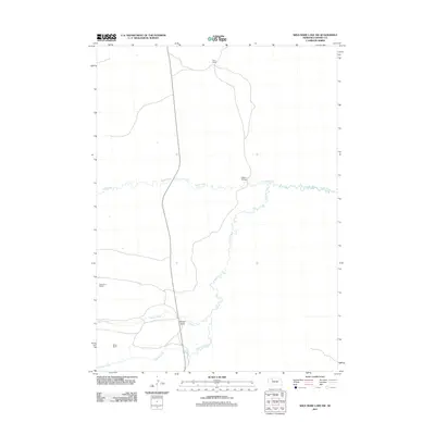
2011 Map of Wild Mare Lake SW
USGS Topo · Published 2011About this map
The Snake River winds across this section of the Nebraska Sandhills, serving as the primary drainage for a landscape defined by ranching and water rights. In this 2011 survey, the remote nature of Cherry County is evident through the sparse network of roads and the isolation of family-named landmarks like the Walt Kime Ranch and Minor Ranch. These sites, along with Minor Camp to the north, reflect the enduring grazing economy of the region. The confluence of Clifford Creek and Willow Creek creates the small valley environment for Willow Valley, while Clifford Bridge provides a essential crossing point over the river’s meandering path. The map provides a detailed view of the water-dependent settlement patterns in a high-plains environment where creeks and river bends determine the location of homesteads and camps.
Find a feature on this map
8 named features on this map. Tap any name to fly to it.
Don’t see what you’re looking for? This feature index may not catch every label — zoom into the map to look around manually.
Map Details
Editions of this 2011 Wild Mare Lake SW Map
This is the sole edition of this map. No revisions or reprints were ever made.
Other maps of this area

1949 · Steverson Lake
USGS Topo · 1:62,500

1949 · Turpin Lake
USGS Topo · 1:62,500

1951 · Steverson Lake
USGS Topo · 1:62,500

1951 · Gypsy Valley
USGS Topo · 1:62,500

1951 · Turpin Lake
USGS Topo · 1:62,500

1951 · Merriman 4
USGS Topo · 1:62,500

1957 · Valentine
USGS Topo · 1:250,000

1959 · Valentine
USGS Topo · 1:250,000

1985 · Mullen
USGS Topo · 1:100,000

1985 · Cody
USGS Topo · 1:100,000