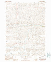
1990 Map of Wild Mare Lake SW
USGS Topo · Published 1990About this map
The Snake River carves a distinct horizontal path across this 1990 Cherry County landscape, serving as the primary geographical anchor for a region defined by its sprawling ranching operations. Significant family-owned properties such as the Walt Kime Ranch and Minor Ranch are documented, illustrating the decentralized settlement pattern characteristic of the Nebraska sandhills. The confluence of drainage systems is evident where Clifford Creek meets the river, while further south, Willow Creek flows through the broad depressions of Willow Valley and Tennessee Valley. A singular crossing point, the Clifford Bridge, provides a critical infrastructure link over the river. This provisional survey captures the isolated outposts of the high plains, including the remote Minor Camp, during an era when the local economy remained tethered to vast grazing lands and seasonal watercourses.
Find a feature on this map
15 named features on this map. Tap any name to fly to it.
Don’t see what you’re looking for? This feature index may not catch every label — zoom into the map to look around manually.
Map Details
Editions of this 1990 Wild Mare Lake SW Map
This is the sole edition of this map. No revisions or reprints were ever made.
Other maps of this area

1949 · Steverson Lake
USGS Topo · 1:62,500

1949 · Turpin Lake
USGS Topo · 1:62,500

1951 · Steverson Lake
USGS Topo · 1:62,500

1951 · Gypsy Valley
USGS Topo · 1:62,500

1951 · Turpin Lake
USGS Topo · 1:62,500

1951 · Merriman 4
USGS Topo · 1:62,500

1957 · Valentine
USGS Topo · 1:250,000

1959 · Valentine
USGS Topo · 1:250,000

1985 · Mullen
USGS Topo · 1:100,000

1985 · Cody
USGS Topo · 1:100,000