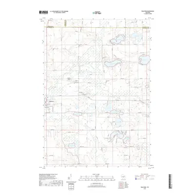
2018 Map of Wild Rose
USGS Topo · Published 2018About this map
Wild Rose serves as the primary hub in this portion of Waushara County, where the village streets meet the waters of Wild Rose Pond. The landscape is defined by an intricate network of glacial lakes and springs, including Gilbert Lake, Kusel Lake, and Lake Napowan, which have long anchored local recreation and seasonal communities. The headwaters of the Pine River and Willow Cr wind through the terrain, fed by unique features like Fenrich Springs.
Find a feature on this map
109 named features on this map. Tap any name to fly to it.
Don’t see what you’re looking for? This feature index may not catch every label — zoom into the map to look around manually.
Map Details
Editions of this 2018 Wild Rose Map
This is the sole edition of this map. No revisions or reprints were ever made.
Other maps of this area

1955 · Green Bay
USGS Topo · 1:250,000

1957 · Amherst
USGS Topo · 1:48,000

1957 · Waupaca
USGS Topo · 1:48,000

1959 · Wautoma
USGS Topo · 1:48,000

1961 · Redgranite
USGS Topo · 1:62,500

1961 · Saxeville
USGS Topo · 1:24,000

1961 · Wild Rose
USGS Topo · 1:24,000
1961 · Redgranite
USGS Topo · 1:24,000

1961 · Spring Lake
USGS Topo · 1:24,000
1968 · Wautoma
USGS Topo · 1:24,000