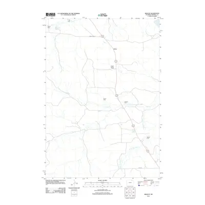
2012 Map of Wildcat
USGS Topo · Published 2012About this map
Wildcat serves as the central point in this part of Campbell County, where the high plains landscape is defined by a complex network of drainage basins. The map illustrates a ranching and water-management system reliant on seasonal watercourses and man-made catchments like Horse Creek Reservoir and Fletcher Reservoir. This area in northeastern Wyoming is characterized by its numerous named draws, such as Bright Spring Draw and Boruff Draw, which feed into larger systems like N Fork Wildcat Cr and Jamison Prong Wildcat Cr. The sparse road network, including Middle Prong Rd and Taylor Rd, highlights the remote nature of these ranch lands in the early 21st century. Geographers and local historians can trace the specific naming conventions of the terrain, from Gibbon Draw to Soukup Draw, reflecting the families and figures who shaped this dry-land territory.
Find a feature on this map
15 named features on this map. Tap any name to fly to it.
Don’t see what you’re looking for? This feature index may not catch every label — zoom into the map to look around manually.
Map Details
Editions of this 2012 Wildcat Map
This is the sole edition of this map. No revisions or reprints were ever made.
Other maps of this area

1954 · Gillette
USGS Topo · 1:250,000

1955 · Gillette
USGS Topo · 1:250,000

1958 · Gillette
USGS Topo · 1:250,000

1962 · Gillette
USGS Topo · 1:250,000

1971 · Wildcat
USGS Topo · 1:24,000

1971 · Oriva NW
USGS Topo · 1:24,000
1971 · Pitch Draw
USGS Topo · 1:24,000

1971 · Recluse
USGS Topo · 1:24,000
1971 · Calf Creek
USGS Topo · 1:24,000
1971 · Rawhide School
USGS Topo · 1:24,000