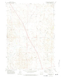
1971 Map of Rawhide School
USGS Topo · Published 1975About this map
The Rawhide School stands as a lonely landmark in this 1971 survey of Campbell County, Wyoming, anchoring a landscape shaped by natural drainage and energy extraction. The western portion of the map is dominated by the Kitty Oil And Gas Field, where numerous Oil Wells and a network of pipelines illustrate the industrial character of the plains during the early 1970s.
Find a feature on this map
22 named features on this map. Tap any name to fly to it.
Don’t see what you’re looking for? This feature index may not catch every label — zoom into the map to look around manually.
Map Details
Editions of this 1971 Rawhide School Map
This is the sole edition of this map. No revisions or reprints were ever made.
Other maps of this area

1954 · Gillette
USGS Topo · 1:250,000

1955 · Gillette
USGS Topo · 1:250,000

1958 · Gillette
USGS Topo · 1:250,000

1962 · Gillette
USGS Topo · 1:250,000

1971 · Gillette East
USGS Topo · 1:24,000

1971 · Wildcat
USGS Topo · 1:24,000

1971 · Oriva NW
USGS Topo · 1:24,000

1971 · Oriva
USGS Topo · 1:24,000
1971 · Calf Creek
USGS Topo · 1:24,000
1971 · Gillette West
USGS Topo · 1:24,000