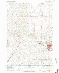
1971 Map of Gillette West
USGS Topo · Published 1975About this map
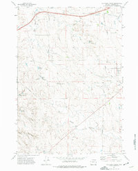
Gillette expands across the high plains of Campbell County during the early 1970s, anchoring a landscape increasingly defined by energy extraction and regional infrastructure. The Oriva Gas Field and a prominent Pipeline illustrate the area's industrial footprint, while the Burlington Northern railroad cuts a vital path toward the town center. Local community life is concentrated in the southeastern corner, where the County Fairground, Jr High Sch, and Hosp serve the growing population. To the north, the County Airport and a Golf Course sit near the winding course of Little Rawhide Creek. The drainage of Stonepile Creek and the southern Donkey Creek provide the primary hydrologic features in an otherwise arid terrain dotted with oil wells and drill holes, marking the intersection of the natural Wyoming prairie and modern industrial development.
Find a feature on this map
24 named features on this map. Tap any name to fly to it.
Don’t see what you’re looking for? This feature index may not catch every label — zoom into the map to look around manually.
Map Details
Editions of this 1971 Gillette West Map
2 editions found
Other maps of this area

1954 · Gillette
USGS Topo · 1:250,000

1955 · Gillette
USGS Topo · 1:250,000

1958 · Gillette
USGS Topo · 1:250,000

1962 · Gillette
USGS Topo · 1:250,000

1971 · Gillette East
USGS Topo · 1:24,000

1971 · Oriva NW
USGS Topo · 1:24,000

1971 · Oriva
USGS Topo · 1:24,000
1971 · The Gap
USGS Topo · 1:24,000
1971 · Appel Butte
USGS Topo · 1:24,000
1971 · Four Bar J Ranch
USGS Topo · 1:24,000