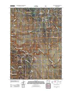
2011 Map of Wildcat Point
USGS Topo · Published 2011About this map
The Middle Fork John Day River carves a central path through this section of Grant County, Oregon, defining a landscape of deep drainages and high points like Wildcat Point. To the northwest, the Willow Creek Cemetery serves as a lone marker of local history near the base of Willow Creek Butte. The map reveals a complex network of forest and county roads, including the Long Creek-Pass Creek Rd and Slide Creek Rd, which navigate the steep terrain between Paradise Canyon and Bum Canyon. These routes provide access to various tributary systems such as Little Indian Creek and Middle Fork Pass Creek, illustrating how the waterway network dictated the placement of early infrastructure and land use in this part of the Blue Mountains region.
Find a feature on this map
29 named features on this map. Tap any name to fly to it.
Don’t see what you’re looking for? This feature index may not catch every label — zoom into the map to look around manually.
Map Details
Editions of this 2011 Wildcat Point Map
This is the sole edition of this map. No revisions or reprints were ever made.
Other maps of this area

1949 · Long Creek
USGS Topo · 1:62,500

1949 · Susanville
USGS Topo · 1:62,500

1950 · Ritter
USGS Topo · 1:62,500

1951 · Susanville
USGS Topo · 1:62,500

1951 · Long Creek
USGS Topo · 1:62,500

1951 · Dale
USGS Topo · 1:62,500

1952 · Ritter
USGS Topo · 1:62,500

1955 · Canyon City
USGS Topo · 1:250,000

1959 · Canyon City
USGS Topo · 1:250,000

1980 · Monument
USGS Topo · 1:100,000