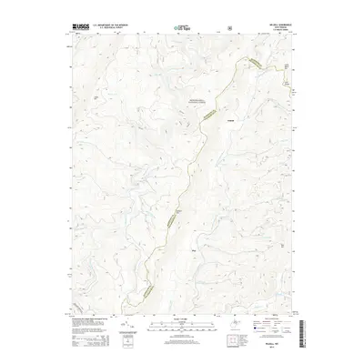
2014 Map of Wildell
USGS Topo · Published 2014About this map
Monongahela National Forest dominates this mountain landscape along the high ridges of the Allegheny Front. The high-elevation terrain is defined by the massive silhouettes of Cheat Mtn and Shavers Mtn, which separate several significant river systems. The Shavers Fork flows through the western valley, while the eastern slopes drain into the W Fork Greenbrier River. Small settlements like Wildell and May are located deep within this protected forest area, reflecting the region's history of timber and remote mountain living. Numerous family-named drainages such as Stalnaker Run, Suter Run, and McGee Run carve into the slopes, providing a detailed look at the watershed geography before these streams reach the larger river valleys. The crest of Lynn Divide and the height of Little Beech Mtn highlight the extreme topography that has shaped the human and natural history of this portion of West Virginia.
Find a feature on this map
32 named features on this map. Tap any name to fly to it.
Don’t see what you’re looking for? This feature index may not catch every label — zoom into the map to look around manually.
Map Details
Editions of this 2014 Wildell Map
This is the sole edition of this map. No revisions or reprints were ever made.
Other maps of this area

1889 · Beverly
USGS Topo · 1:125,000

1892 · Beverly
USGS Topo · 1:125,000

1909 · Elkins
USGS Topo · 1:62,500

1922 · Horton
USGS Topo · 1:48,000

1922 · Spruce Knob
USGS Topo · 1:48,000

1922 · Durbin
USGS Topo · 1:48,000

1924 · Durbin
USGS Topo · 1:62,500

1924 · Horton
USGS Topo · 1:62,500

1924 · Spruce Knob
USGS Topo · 1:62,500

1949 · Charlottesville
USGS Topo · 1:250,000