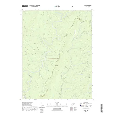
2019 Map of Wildell
USGS Topo · Published 2019About this map
Shavers Fork and the W Fork Greenbrier River define the hydrography of this high-elevation landscape along the Randolph Co Pocahontas Co border. Situated within the Monongahela National Forest, the terrain is characterized by prominent ridges like Cheat Mtn, Shavers Mtn, and Whitmeadow Ridge. The settlement of Wildell is positioned on the W Fork Rail Trail, marking the historical path of the local rail economy through these steep mountain gaps.
Find a feature on this map
43 named features on this map. Tap any name to fly to it.
Don’t see what you’re looking for? This feature index may not catch every label — zoom into the map to look around manually.
Map Details
Editions of this 2019 Wildell Map
This is the sole edition of this map. No revisions or reprints were ever made.
Other maps of this area

1889 · Beverly
USGS Topo · 1:125,000

1892 · Beverly
USGS Topo · 1:125,000

1909 · Elkins
USGS Topo · 1:62,500

1922 · Horton
USGS Topo · 1:48,000

1922 · Spruce Knob
USGS Topo · 1:48,000

1922 · Durbin
USGS Topo · 1:48,000

1924 · Durbin
USGS Topo · 1:62,500

1924 · Horton
USGS Topo · 1:62,500

1924 · Spruce Knob
USGS Topo · 1:62,500

1949 · Charlottesville
USGS Topo · 1:250,000